Friday, June 23, 2006
Day 5 - John Day - 23rd June 2006
Weather: Sunny 89
Location: John Day, Oregon (from Prineville, Oregon)
Miles per day: 117.6
Average miles per hour: 11.83
Flat tires to date: 1
Blizzards consumed to date: 3
This will be short as there is limited internet access at the hotel. Today was full of highs and lows. We started out with a 2500 foot climb with a strong headwind (which makes it VERY difficult). Cyclist talk about the 3Hs... Heat, Headwinds and Hills. Today we had it all.


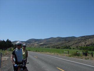

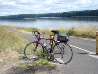
With a 100 plus miles, this is known to hardcore cyclists as the Century. For a novice such as myself, I can only describe it as incredibly challenging. On picking this tour, the itinerary is summarised with location and number of miles. As I reviewed it, I concluded the easy days would be the long mileage days and the difficult days would be the short mileage. As it turns out, the distance is simply determined by where there is an available hotel. Hence, a long day can have difficult hills. Today was such an example. We came out of Prineville and it was a straight shot on Route 26 to John Day. The initial terrain was pine tree forest, some showed signs of fires from previous years (see photo). The air was cool and the ride was very pretty which compensated for the constant uphill climb for nearly 30 miles. We then went through Ochocco Pass (elevation 4720 feet) and descended for nearly 7 miles. Seeing the 7 mile descent sign makes a cyclist day (see photo). It was a wonderful drop going about 30 plus mph. But what goes down must go up.... it was followed by a brutal 5 mile climb at 5% plus grades. Once up on the plain, it then descended to flat terrain along the John Day River into John Day.
I took a brief break to check out the rocking chair. The natural wood furniture was amazing (see photo for website). Tell em the crazy bike crowd sent you!....
Today, was personally challenging and I learned that cycling can be a real mental sport. Starting out with 29 miles of hill and head wind, my mind often drifted to the option of the 'Sag Wagon' which will take you to the hotel. I mentally had to beat off those thoughts mile after mile. I am happy to say, both focus and distractions helped me throughout the day. I had alot of support from other cyclist. Small words of encouragement or rest stops with small talk about anything but how long we had left to go made the time go by quite quickly. And of course, with the sighting of the Dairy Queen (DQ) sign with 2 miles to go, I managed to pick up the pace and finish the last few miles at 20 mph!
Tomorrow is a lower mileage day - just 82..... But with the weather holding and my endurance strengthening, things are getting easier.
Location: John Day, Oregon (from Prineville, Oregon)
Miles per day: 117.6
Average miles per hour: 11.83
Flat tires to date: 1
Blizzards consumed to date: 3
This will be short as there is limited internet access at the hotel. Today was full of highs and lows. We started out with a 2500 foot climb with a strong headwind (which makes it VERY difficult). Cyclist talk about the 3Hs... Heat, Headwinds and Hills. Today we had it all.


With a 100 plus miles, this is known to hardcore cyclists as the Century. For a novice such as myself, I can only describe it as incredibly challenging. On picking this tour, the itinerary is summarised with location and number of miles. As I reviewed it, I concluded the easy days would be the long mileage days and the difficult days would be the short mileage. As it turns out, the distance is simply determined by where there is an available hotel. Hence, a long day can have difficult hills. Today was such an example. We came out of Prineville and it was a straight shot on Route 26 to John Day. The initial terrain was pine tree forest, some showed signs of fires from previous years (see photo). The air was cool and the ride was very pretty which compensated for the constant uphill climb for nearly 30 miles. We then went through Ochocco Pass (elevation 4720 feet) and descended for nearly 7 miles. Seeing the 7 mile descent sign makes a cyclist day (see photo). It was a wonderful drop going about 30 plus mph. But what goes down must go up.... it was followed by a brutal 5 mile climb at 5% plus grades. Once up on the plain, it then descended to flat terrain along the John Day River into John Day.
I took a brief break to check out the rocking chair. The natural wood furniture was amazing (see photo for website). Tell em the crazy bike crowd sent you!....
Today, was personally challenging and I learned that cycling can be a real mental sport. Starting out with 29 miles of hill and head wind, my mind often drifted to the option of the 'Sag Wagon' which will take you to the hotel. I mentally had to beat off those thoughts mile after mile. I am happy to say, both focus and distractions helped me throughout the day. I had alot of support from other cyclist. Small words of encouragement or rest stops with small talk about anything but how long we had left to go made the time go by quite quickly. And of course, with the sighting of the Dairy Queen (DQ) sign with 2 miles to go, I managed to pick up the pace and finish the last few miles at 20 mph!
Tomorrow is a lower mileage day - just 82..... But with the weather holding and my endurance strengthening, things are getting easier.
Thursday, June 22, 2006
Day 4 - Prineville, Oregon - June 22, 2006
Weather: Sunny, clear and low 80s
Location: Prineville, Oregon (from Kah-na-tee, Oregon)
Miles per day: 61.67
Average miles per hour: 11.29
Top Speed: 37.5 MPH
Climb: 3990 feet
Flat tires to date: 1
Blizzards consumed to date: 2
For all those reading this from your desk at work, you may be nauseated to hear that today was just another amazing day of riding and weather. The scenery is oozing of fresh beauty - rolling hills, wildflowers and fresh country air smells. We started out about 7:15am from Kah-na-tee with some early hills taking us out of the canyon. Within 5 miles, we went around a bend to see a team of wild horses thundering past us. The sight and sound was amazing. Within minutes they were up in the mountains.
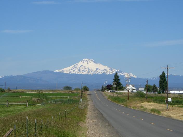
Up on the plains, you could see for 'miles and miles and miles' (you know the song). Out in the distance, there were the snow capped mountain ranges (Mount Jefferson amongst the most beautiful). On a side note, for safety, no one in the group is allowed to wear ipods. Some are struggling with the silence of many miles of road. Although most of us have started singing in our heads all songs of course related to travel. One that keeps popping into my head is 'Whoa, you are half way there, living on a prayer.' Bonjovi. 'Life is a winding road'.... 'Driving (riding) my life away, looking for a better way' (Kenny Loggins)...
So I am told that with the miles we are doing, the average person burns 6,000 to 8000 calories per day. Naturally, that leads to an excuse to stop at evey Dairy Queen in sight. As we pulled into Prineville, we spotted one! Consumed 1 Cookie Dough Blizzard. Delicious.
Thinking how could things get any better, we exited to the parking lot to find my first flat tire. The two of us together both had flats - bad luck in some respect but we were within 1 mile of the hotel. On the positive side, I learned to fix a flat (a first for me) and something I have been very anxious about. All in all, a good experience without the stress of miles or bad weather.
We topped off the evening dropping in on the 'Crooked River Roundup' Kickoff Festival with an outdoor band playing 'Sweet Home Alabama'. Lots of real Cowboys. Another great day.
Tomorrow: 5:30 AM start and 117 miles and 5500 feet climb - perhaps some sympathy... I will need all I can get.
Wednesday, June 21, 2006
Day 3 - Kahnatee Indian Reservation, Oregon - June 21st, 2006
Weather: Early overcast to sunny afternoon skies. Temperatures ranged from mid 50s to low 70s
Location: From Welches, Oregon to Kah-na-tee, Oregon
Miles per day: 66.4, Average miles per hour: 11.93 (slow due to a 13.2 mile climb through Mount Hood park)
Top speed: 35.00 MPH
After we were given the itinerary at last night's 'route rap', I found sleeping a bit of a challenge. All I could think of was the casual mention that we were starting at 5:45 AM and there was 11.2 mile climb to an elevation of 3990 feet with a total 2500 foot climb. Following that, there were repeated ups and downs. My only objective of each day is to avoid the 'sag wagon' and enjoy the day. Today, I managed both.
It was a long day. As we circled around Mount Hood, I was distracted by the increbibly stunning views and wildlife. One woman saw two bears. There were wild horses and once on the Indian Reservation, free roaming cattle as well as dogs chasing bikes (my greatest fear on this trip). The good news about being last in the group is after chasing 50+ bike riders, the dogs had no energy left to chase me.
In the distance, across the plains, you could see the Mount Jefferson and Mount Washington, stunning snow capped mountains. The scenery has started to change from dense Douglas Fir trees to open plains with rolling hills. The temperatures are starting to rise.
As we were gazing into the distance and began racing down hill into Box Canyon towards Kahnatee, our conversation turned naturally to Old Western Movies as the views reminded us of any number of them, particularly City Slickers and True Grit.
Another glorious day!
Tuesday, June 20, 2006
Day 2 - Welches, Oregon - June 20th, 2006
Weather: Sunny 60s F (20s C)
Location: Welches, Oregon (very close to Mount Hood)
Miles per day: 77.31
Average miles per hour: 12.83
Total climb: 2900 Feet
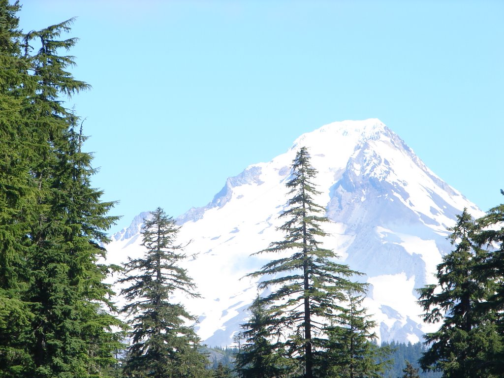
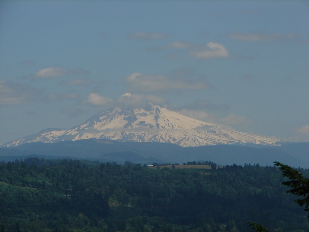
A great ride today (for me that means, relatively flat terrain with sunny but cool air) along the Colombia River down through Portland and heading inland towards Mount Hood (45 miles from Portland). NOTE WELL: The capital of Oregon is Salem (not Portland). We had spectacular views all day of Mount Hood. Breathtaking.
 Mount Hood is the tallest mountain in Oregon (11,237 feet, 3,426 m). Mount Hood is a stratovolcano which was formed about 500,000 years ago. Last eruption was estimated at 250-180 years ago and scientist predict an eruption within the next 75 years. It is the 4th highest in the string of Cascade Mountain Range volcanoes that stretch from Mt. Garibaldi in British Columbia south to Mt. Lassen in Northern California. TRIVIA: Tallest is Mount Ranier (14,410 feet) in Washington State.
The first white men "discovered" the Mount Hood on October 29, 1792, when British Navy Lt. William E. Broughton and his crew (representing King George III) saw it from the Columbia River near the mouth of the Willamette River. Broughton named the peak for famed British naval officer (and later, Admiral) Alexander Arthur Hood (who never saw the mountain). It was first climbed in August 14, 1845. Today, Mt. Hood is the second most climbed mountain in the world, second only to Japan’s holy Mt. Fujiyama.
We arrived at a lovely resort with Scottish roots - or so they say as this area is 'so reminiscent of the Scottish Highlands'. The most notable Scottish figure in this area was David Douglas, an eighteenth century botanist for whom the Douglas Fir (tree) was named.
Monday, June 19, 2006
Day 1 - St Helens, Oregon - June 19th, 2006

Weather: Sunny 60s F (20s C)
Location: St Helens, Oregon
Miles per day: 70.2
Average miles per hour: 12.90
Today was a challenge far beyond any of my training. That said, it was a great day. We had our official photo at the hotel and headed out about 7:30 AM. I was humbled by the scores of older folks (70 plus) on this trip who are cruising past me at 17 MPH. I had the honours for bringing up the rear. That said, I did stop a few places along the way: Gnats Fish Hatchery, Bradley Park, Trojan Park (with its own nuclear plant).
We followed the Lewis and Clark Trail who in 1805 made it to the Oregon Coast. (more on this later). Most of the day was spent following the Colombia River with beautiful views.
The challenge of the day was sharing the road with mammoth logging trucks barrelling down past me at 70 mph. There's good reason I bought trip insurance.
Sunday, June 18, 2006
Day 0 - Astoria, Oregon - June 18th, 2006
Weather: Sunny with high clouds. Mid 60sF (21C)
Location: Astoria, Oregon
Miles per day: 24.44
Average miles per hour: 14.04
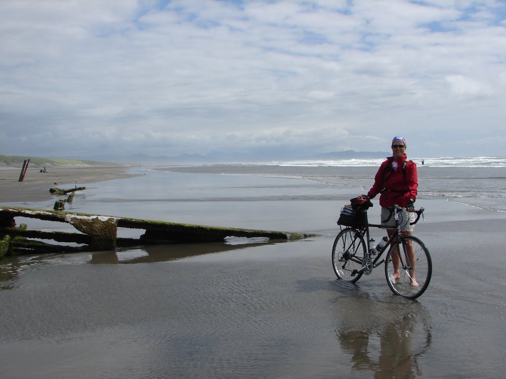
Today was official wheel dipping day at Fort Stevens, Warrenton,Oregon at the mouth of the Colombia River. Over 100 years ago, young soldiers dressed in Union blue stood watch over Fort Stevens at the mouth of the Columbia River. Originally commissioned as a Civil War fortification in 1863, Fort Stevens was deactivated as a military fort shortly after World War II. TRIVIA: Fort Stevens enjoys the distinction of being the only military installation in the continental United States to be fired on since the War of 1812. On the night of June 21, 1942, the Fort was the target of a Japanese submarine which fired 17 shells in the vicinity of the Fort. The shelling caused no damage and Fort Stevens did not return fire.
It has fabulous bike trails and provides the opportunity to get lost easily which I managed quite nicely. I wonder how I will find Portsmouth, NH at this rate.
Tomorrow begins the official trip - watch this space.
![]()